
Garmin’s Basecamp is one of the most popular Geographic Information System (GIS) that boasts with extensive functions when it comes to planning your next adventure. In another article we went over some of the basic functionalities of Garmin Basecamp and I explained how we use it to create our GPX tracks for our trips. But we have to say that the software is not always self-explanatory, and it comes with a quite steep learning curve which requires investing some time to get used to it and to use it effectively. If you are looking for an alternative you are in the right place, because in this post we are looking at two alternatives and explore their functions and see how they compare the good old Basecamp.
Related: Check out our Comprehensive Guide on Off-Road Motorcycle Navigation where we cover all topics from planning to execution.
Table of Contents
QMapShack
An open-source program to view maps and view/edit waypoints, routes and tracks and plan routes. It can be compared with Garmin BaseCamp/Mapsource/Roadtrip and is the successor of QLandkarte GT. It is licensed under GPL3+ and is available for *nix, Windows and OS X systems.
What we like
Multi OS Support – QMapShack is available for Windows, Mac and Linux, unlike Basecamp which is not available on the latter.
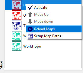
Great Map Manager – Loading custom maps is a breeze in QMapShack. It takes a only a couple second to drag a map to its map path and reload it on the map manager. This is one of my favorite features on QMapShack and no other GIS comes close. In Basecamp loading custom maps is only possible by plugging in a device and choosing it from there. There is a workaround by creating a virtual drive but come on Basecamp, you could do better.
Great map GUI – hovering over different tracks and selecting them is so easy in QMapShack. In Basecamp you have to click on the track in order to select and highlight it on the map. When you have hundreds of tracks in one project, Basecamp becomes chaotic.
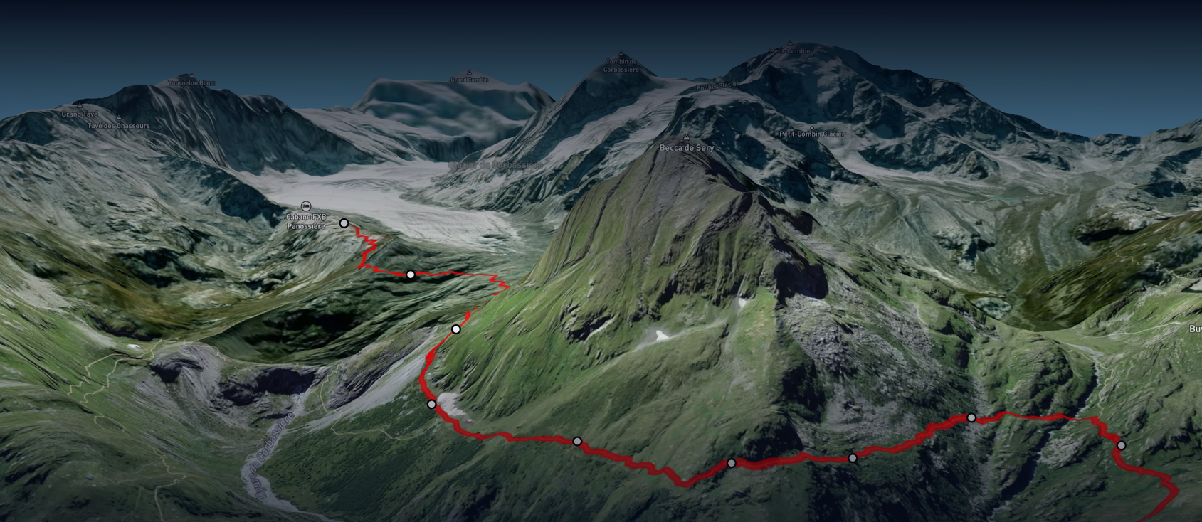
Show/hide track directions – Knowing the direction of track is really important, not only for editing but also for planning. Having the option to show the direction of all tracks on the map is a cool feature that is only available in QMapShack. On Basecamp it only shows the direction on the track that is currently selected.
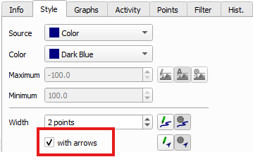
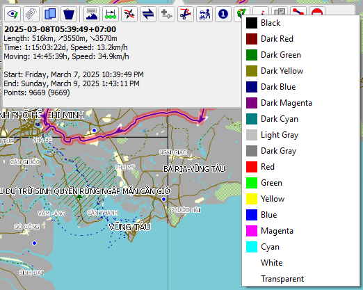
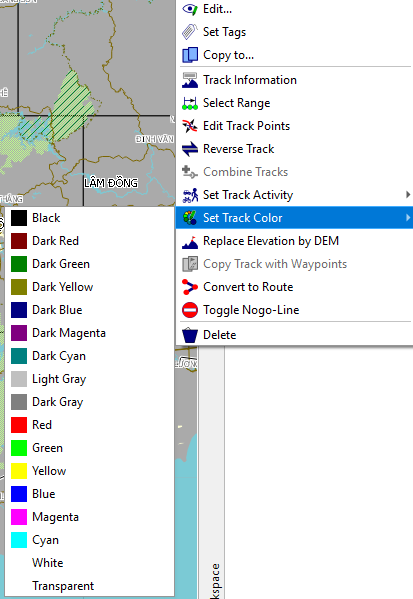
Formatting tracks is quick and simple – On QMapShack changing a track color is just a few clicks away, either by selecting the track on the map or by using the workspace panel and selecting it from its list. On Basecamp you need to open the track detailed information first and then you can choose the track color.
Software Speed – The speed is mainly depending on the loaded map, so comparing different GIS that are using different maps is not a fair comparison. However, this highlights again the flexibility of QMapShack where you can select a light map and can enjoy a super responsive and fast map to work with.
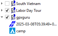
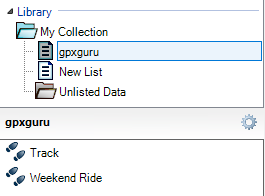
Clean and neat Library/Workspace – While Basecamp has a two layer structure and you have to select the Collection first to see all tracks that belong to it, you can see all projects at one glance in QMapShack’s workspace panel, where you can expand and collapse the individual projects. This makes working with multiple projects at the same time much easier.
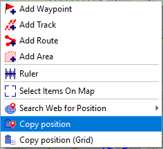
Copy position/location feature – When working with Google Earth and QMapShack simultaneously which I find myself doing very often, this feature is very useful. When I want to look up a location on Google Earth’s satellite imagery I simply copy the position and paste it into Google Earth. In this article I explain in more detail how I usually use the Google tools for exploring new trails.
What we dislike
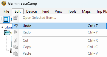
No Undo function – On Basecamp going back one step after accidentally deleting something is as simple as pressing CTRL+Z or choosing ‘Undo’ from the ‘Edit’ menu. On QMapShack making a mistake can’t be recovered so easily, if you delete it’s gone.
Inverting/reversing is more work – While on Basecamp inverting the direction of a track is as simple as selecting it from the context menu, on QMapShack it requires a few extra steps. Namely, it will copy the track you are trying to invert and create a new one under the same project with a suffix. You then have to delete the original to get to the same result as Basecamp.
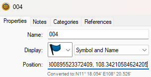
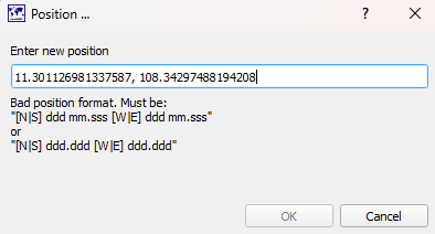
Coordinates are not automatically converted – When pasting coordinates from Google into a waypoint location, Basecamp automatically converts the location into the correct format. On QMapShack it does not accept it and you have to manually correct the format. It is just two letters that need to be added but it is extra work and Basecamp does it better.
GPX.Studio
A free, online tool for working with GPX files. It allows you to create, edit, and export GPX tracks. The tool offers features for route planning, advanced file processing, and integrating maps into your website.
What we like
Platform independence – Probably the best feature about GPX.Studio is the fact that it can be opened anywhere on any system because it is a browser application that does not require any installation beforehand.
It is free to use and ad-free – Unlike other web applications this one is free and does not bombard you with advertisements.
Great for quick edits – It doesn’t offer the same scope of functions as a fill-blown GIS, but it covers the most important features and can do most of them pretty well and is therefore a great choice for people who want to edit their tracks without installing a software for it.

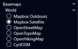
Satellite image available – The application offers a selection of maps to choose from and one of them is a satellite image from Mapbox. Which is great, because neither Basecamp nor QMapShack supports satellite imagery, which is the reason why for satellite imagery we turn to Google.
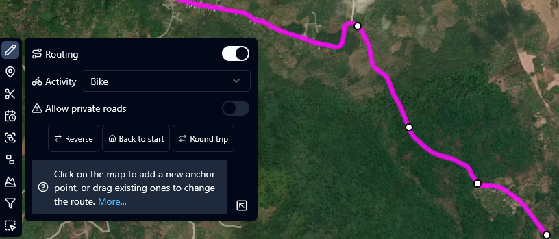
Routing option is a great feature – When drawing tracks, GPX.Studio has a radio button for “Routing”, when activated the drawn track will stick to the underlying paths if available. This is a great feature as it makes drawing tracks much faster and more accurate.
What we dislike
Lacks functionalities – This is where a real GIS shines, the functions in GPX.Studio are rather limited.
No option to upload custom maps – On GPX.Studio we have to use the map layers that are available, which might be sufficient for most users.
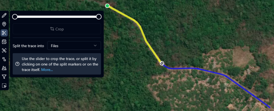
Splitting tracks feels unusual – The split function in GPX.Studio feels unsual because it is slightly different from the other GIS. You select from the left side menu the split function and then can either crop the beginning or end of the selected track or choose a location at which you want to split a track. You are then asked if you want to split the pieces into seperate files, tracks or segments. The split pieces then appear on the file tree of the application.
No library function – The application shows a file tree of all GPX files that are open at the moment, but once you close the app everything is gone and progress is lost unless you exported everything in time.


Greetings from Uganda.
I am Twesige Selegio, Director of Wilma Fox Child Development Centre Uganda, a non-profit organization dedicated to supporting orphans and vulnerable children in Uganda. We provide essential services including education, healthcare, and emotional support.
We are excited to explore potential partnership opportunities with your organization. A collaboration could enhance our impact and better serve the children we care for. We are interested in exploring partnerships in the following areas:
1. Nutrition Programs: Providing nutritious meals and promoting healthy habits.
2. Education and Development: Supporting early childhood development, education, and vocational training.
3. Community Outreach: Empowering communities to promote health, education, and well-being.
By partnering together, we can leverage our strengths and experience to create lasting change. I would be honored to discuss this opportunity further and explore how we can work together.
https://www.globalgiving.org/donate/104179/wilma-fox-child-development-centre/ you can see more of our projects.
Please feel free to contact me to schedule a call or meeting. I can be reached via WhatsApp at +256785521916.
Best Regards,
Twesige Selegio
Director, Wilma Fox Child Development Centre Uganda