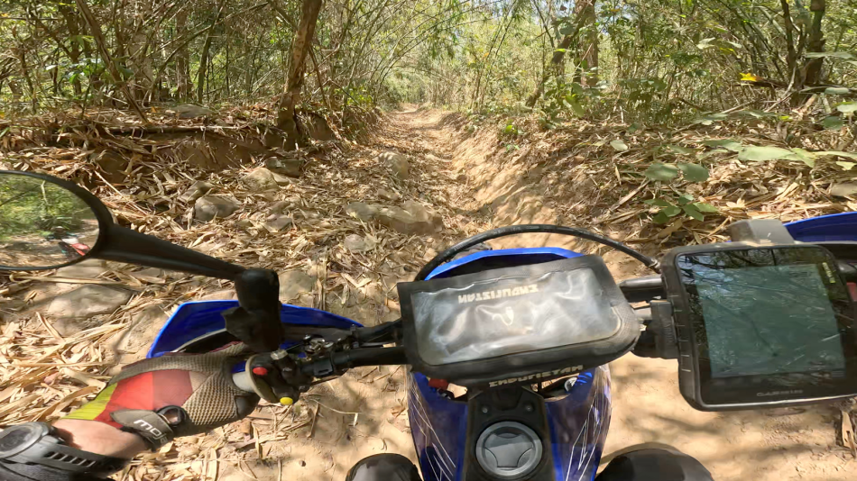
We are going on a five day ride this weekend, and it is the end of the dry season in Vietnam, which means temperatures get extremely hot and there is a risk of heavy rain showers. To be prepared, I always review the weather forecast on the days before the trip.
Related: Check out our Comprehensive Guide on Off-Road Motorcycle Navigation where we cover all topics from planning to execution.
Table of Contents
When I try to look up the weather on Google Weather, it usually shows me something like this:
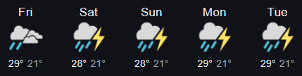
That is not really helpful, as it tells me that there is going to be a chance if rain somewhere in the area where I am going to be riding. If I look into the details it provides me a “probability of precipitation” in a percentage over time.
What does this actually tell me? It is fancy wording for “chance of rain”. But the percentage that is shown basically gives me the statistical probability that rain will fall at some point at some time within the area. Example: When it says 20% chance of rain, there is a 20% chance that at least 0.01 inches of rain will fall somewhere within the forecast area.
Still… This does not really help me when planning a trip.
But what could be helpful? A visual weather forecast where I can see how the weather changes over time in what area.
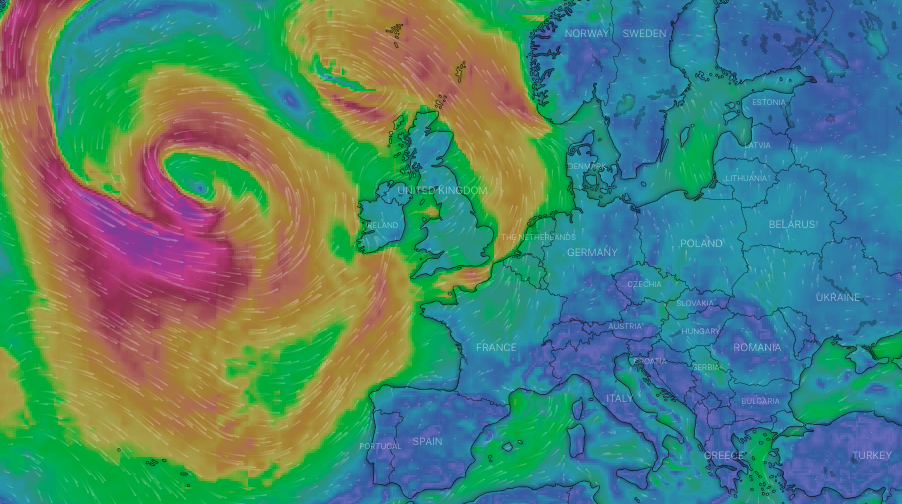
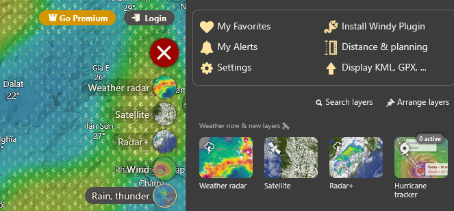
To do this I use the tool Windy.com.
What is Windy?
Windy is an interactive weather forecasting service providing detailed and visualized weather data. It includes high-resolution weather maps, wind forecasts and satellite images, offering a wide range of meteorological information beyond the basic weather forecasts.
How do I use it?
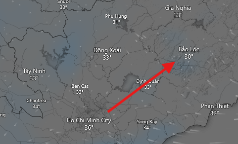
On Windy.com I select in the menu bar on the right “Rain, thunder”. Then I zoom in on the area that I will be riding in. The main advantage of using a visual weather map is that I exactly see when the weather is changing in what area, since I will be travelling from one area to another.
In this example I will travel from Ho Chi Minh City to Bao Loc.
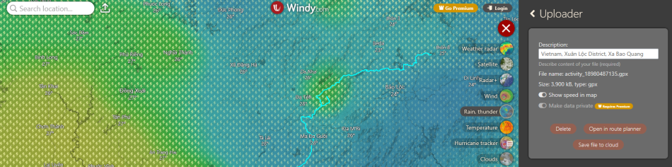
Upload GPX file to display the planned route in Windy
If we have a GPX track file which we prepared beforehand as we describe in another article, then we can upload this file in Windy and use it to plan for our ride. The website also accepts KML files, so if you have downloaded your track file from Google MyMaps or Earth (see our guide on how to use these tools effectively), you can also upload this file here.
After uploading, we can see our track file on the map.
We continue by selecting “Open in route planner” for more options. If we select in the bottom menu “car/hike” we get to select an average travel speed which calculates the time required for the planned route. We will get weather forecast information for each section accordingly. However, if we travel off-road the speed is rarely consistent, so basing this plan on an average speed might not be too accurate. However, it is still useful to see the forecasted weather along the track.
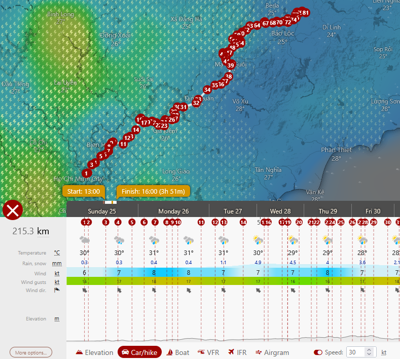
Use the timeline tool to forecast the weather along the route
What I like to use instead is the timeline on the bottom on the screen. We can use this timeline to view the upcoming days and see how each area that I will be travelling through is affected by the weather. In the free version which I am using I can look 5 days into the future which for my case is completely sufficient.

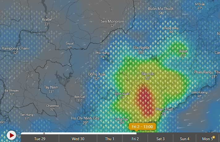
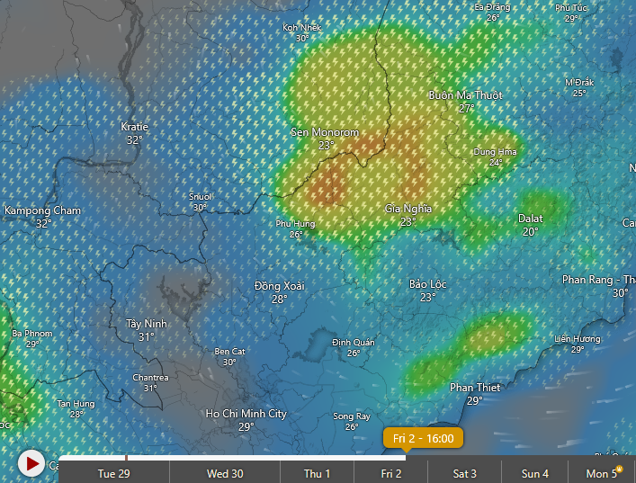
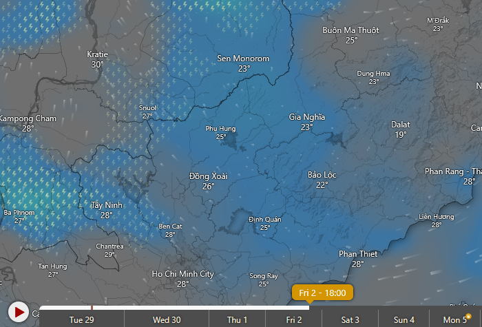
As the timeline moves through the upcoming days I monitor the weather changes. Up until Friday it looks like we are lucky and there is no rain or storm coming in the area. Only on Friday, there is around 1PM south of Bao Loc a storm coming (Picture 1), which will then move further north until around 4PM (Picture 2), before it will stop at around 6PM (Picture 3). On this day we better try to start our ride early, and be somewhere safe before the rain starts in the early afternoon.
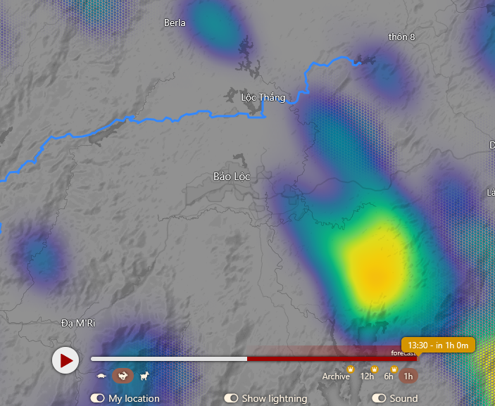
View live weather data for up to 60 minutes
For the most accurate weather data we like to use the “Weather radar” which can look into the future for up to 60 minutes in the free version. This is especially useful to decide whether to continue heading into a very remote area or not if there is a chance of rain or storm in that area. By moving the timeline on the bottom of the screen from now to up to 60 minutes in the future we can see how a storm is developing and in which direction it is heading.
I hope this is as helpful to someone as it was for me. Because planning an adventure ride not only includes having well prepared tracks and routes, but also taking into consideration environmental factors such as the weather because out on the trails the weather can have adverse effects on our riding conditions.